North America · Illustrated record
Playa Bavaro
Punta Cana · Dominican Republic

The short version, from the cited sources
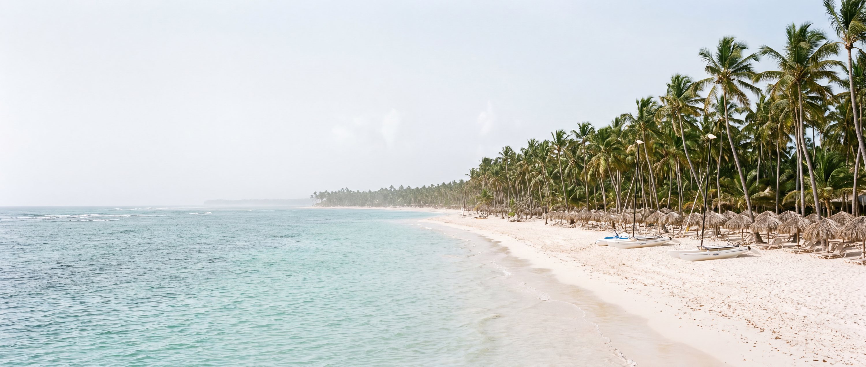
Bavaro Beach anchors the Punta Cana coast at the eastern tip of the Dominican Republic, where a nearly continuous line of coconut palms fronts miles of white coral sand and reef-tamed turquoise water. It carries one of the largest all-inclusive resort concentrations in the world, yet the scale of the beach absorbs it; long stretches between properties remain uncrowded. The offshore reef keeps the swimming zone typically gentle.
- Country
- Dominican Republic (DO)
- Region
- North America
- Sand
- White
- Water
- Warm, reef-sheltered water
- Administrative area
- La Altagracia Province
- Timezone
- America/Santo_Domingo
- Source family
- GeoNames
- Source updated
- 2017-11-30
Names in the record
Playa Bavaro
- Playa Bávaro
Awaiting editorial review
Not yet recorded for this beach
- Access and accessibility
- Facilities and lifeguards
- Seasonality and crowd pattern
- Current hazards and restrictions
- Live weather, tide and water-quality feeds
Source position
18.71666, -68.45006
The map uses the coordinate supplied by the cited record. Local access and water entry are not implied.
Direct provenance
Sources behind this record
The source’s own accuracy and completeness disclaimer applies. Submit a correction if this point represents an alias or duplicate.
- GeoNames Gazetteer ExtractGeoNames ↗
Beach features T.BCH and T.BCHS from the dated global dump; supplied as-is by GeoNames.
Creative Commons Attribution 4.0 · Retrieved 2026-09-02 - Wikipedia beach articlesWikimedia Foundation ↗
Encyclopedia articles used for the editorial summary of illustrated records; the per-record citation links the specific article.
Creative Commons Attribution-ShareAlike 4.0 · Retrieved 2026-10-04