A white church with a red roof above a snow-covered village, with dark sea stacks and cliffs on the coast beyond

region field guide

South Iceland

A coast of volcanic sand, sea stacks, glacial rivers and powerful North Atlantic exposure.

Photo: Jon Flobrant / Wikimedia Commons

Climate context

What changes through the year

Fast-changing weather and surf are defining conditions. A scenic shore is not automatically a swimming beach.

Getting around

How the coast connects

The Ring Road links the region’s main towns, but weather and road notices can change quickly.

Where and when

Position, and the shape of the year.

Both panels are drawn from facts the atlas holds: recorded coordinates and the latitude itself. Neither is a forecast.

Locator map of South Iceland: sourced beach coordinates around 63.404, -19.047, with the destination centre marked
19 sourced beach records inside a frame roughly 865 km wide, plotted server-side from the atlas index over Natural Earth land outlines (public domain). The marked point is the coordinate in this record; every other mark is a beach record you can open from the directory.
Hours between sunrise and sunset, computed from latitude 63.404 alone. This is astronomy, not weather: no temperature, swell, rainfall or “best month” claim is implied for South Iceland. Longest around Jun (19h 54m), shortest around Dec (4h 06m) — a 15.8-hour swing across the year.

Launch coverage

Beaches in South Iceland

Coverage grows by reviewed entities, not automatically generated locality pages.

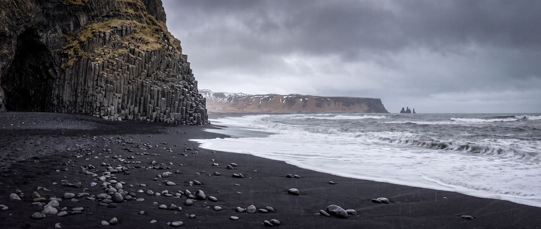
Wide view of Reynisfjara, Vik, Iceland.
Europe

Reynisfjara

Vík · Iceland

Sand
Black
Water
Cold, powerful North Atlantic surf

The rest of this coast

Sourced records nearby

6 beach records sit within 60 km of this coordinate. The nearest are listed below with their distance; most carry position and provenance only, and say so on the page.

  1. SólheimafjaraSouth, Iceland15.9 km
  2. SkógafjaraSouth, Iceland23.6 km
  3. MeðallandsfjörurSouth, Iceland58.6 km
  4. SkaftafellsfjaraEast, Iceland101.0 km
  5. SvínafellsfjaraEast, Iceland108.8 km

Search the directory around South Iceland →

Destination provenance

Sources

  1. ReynisfjaraWikipedia contributors ↗

    Used for basalt geology, black sand and geographic identity. Safety language is deliberately conservative.